Sea Level Rise: The Silent Killer Targeting San Rafael's Most Vulnerable Neighborhood
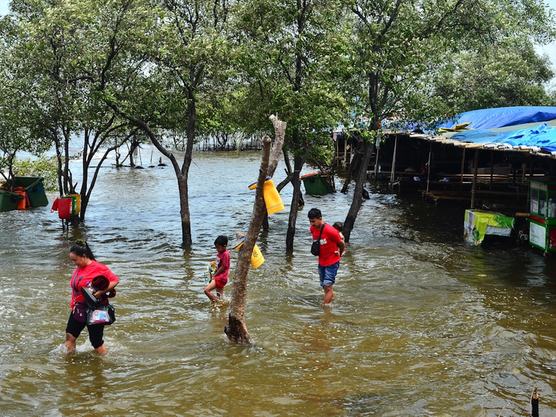
Photo by Iqro Rinaldi on Unsplash
Climate change isn’t just about polar bears and melting ice caps anymore - it’s literally coming for your neighborhood, and San Rafael’s Canal community is ground zero for this watery apocalypse.
The Canal district, home to approximately 16,000 predominantly Hispanic residents, is facing an existential threat from rising sea levels that could turn this vibrant community into an isolated island faster than you can say “climate crisis”.
A Perfect Storm of Vulnerability
With exit roads sitting just three to four feet above sea level, residents are essentially living on borrowed time. NASA data shows sea levels are rising at a terrifying 0.17 inches annually, which might sound small but adds up to significant flooding risks during winter storms and king tides.
The Human Cost
This isn’t just about water - it’s about people. Nearly a quarter of Canal residents live below the poverty line, and two-thirds lack a high school diploma. These are the essential workers who keep wealthy Marin County running, and they’re the most at risk when flooding cuts off their only escape routes.
No Easy Escape
Imagine being trapped with no way out, your car underwater, and emergency services struggling to reach you. That’s the stark reality facing Canal residents. With no public evacuation maps and limited infrastructure planning, this community is facing a climate catastrophe that feels depressingly inevitable.
As Kate Hagemann, San Rafael’s Climate Adaptation Planner, ominously notes: we’re “on a train that doesn’t stop”.
AUTHOR: mp
SOURCE: Local News Matters